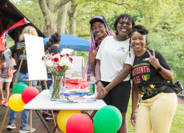
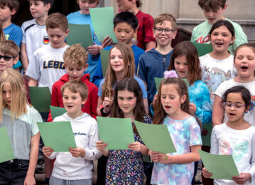
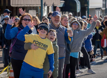
Check out what’s
Trending
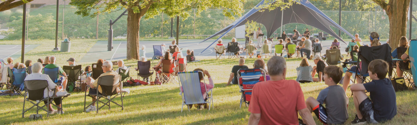
Final Friday summer concerts
This is Home.
If you aren’t sure where to look for specific information on our website, please search here using keywords to learn anything from what day trash pick-up is, how to license your pet or plan a block party to how to volunteer in the community or start a business here.
By Wallace F. Workmaster
Mt. Lebanon is spread across more than six square miles of Western Pennsylvania’s hills, but it once was contested land.
Surveys were made on May 25, 1770, for James McFarlane’s “Black Oak Hill” within what was to become Mt. Lebanon and a neighboring tract, probably now in Dormont, occupied by an individual named Price. A Pennsylvania patent for the McFarlane land was not received until November 27, 1788, perhaps because Virginia had included this territory in the western part of its County of Augusta and, later, the County of Youghioghenia. From 1774 until 1780, Virginia enforced laws, sold land, and collected any taxes paid in the region.
Area farmers sought to avoid a federal excise tax on whiskey in 1794. As part of the largest civil uprising between the Revolution and the Civil War, a two-day attack destroyed “Bower Hill,” the nearby plantation of Inspector of Revenue John Neville, an act that brought an army of 11,000 men to enforce the laws of the new federal government. Threat from Native American attacks remained real until 1794 – 1795.
The state road from Pittsburgh to Washington, PA, was undertaken in 1797 and a stagecoach later plied the route until about 1874. Six-horse teams labored to pull heavy wagons, sometimes up to their knees in mud after wet weather. Drovers moved herds of sheep, cattle, and fattened hogs to market in Pittsburgh, pausing at Thomas Alderson’s Five Mile House or at John Conner’s inn. Hay, straw, grains, vegetables, fruits, and dairy products put cash in farmers’ pockets.
About 1850, the Rev. Joseph Clokey brought back two Cedar of Lebanon trees from a trip to the Near East and planted them in front of his home off Bower Hill Road. Mt. Lebanon’s name was taken from a particular mountain in a region of the Ottoman Empire, known today as the Republic of Lebanon, which is the only place in the world where those trees grow natively, Mount Lebanon. The name has been in official use in this locale since the first post office was established and a postmaster was appointed in 1855.
A narrow gauge railroad, the Pittsburgh Southern, operated across bucolic Mt. Lebanon on its way toward Washington, PA, between 1878 and 1883, reaching Temperanceville (West End) from Banksville over an inside rail on the standard gauge Little Saw Mill Run Railroad. Another slim gauge line, the Pittsburgh & Castle Shannon, served a Methodist camp ground just inside the future Mt. Lebanon Township above Arlington Station.
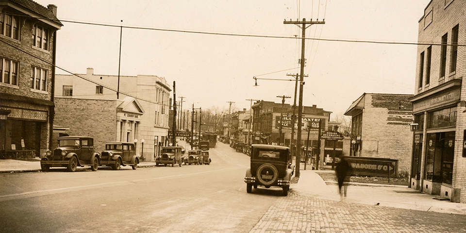
Farming was the principal way of life into the early 1900’s, although coal was mined underground from 1883 until 1923. Streetcars to Pittsburgh began to operate on July 1, 1901, and, four and one-half months later, the first real estate subdivision, the Mt. Lebanon Plan, was laid out. A second one, the Clearview Plan, followed in February, 1902. By 1905, no less than 11 subdivisions had been approved within the future boundaries of the Township of Mount Lebanon. Transformation from rural countryside into a modern suburban community was underway.
Although the development of Mt. Lebanon never was as strongly influenced by electric railway transportation as Beechview and Dormont were, between 1903 and 1909 heavy interurban cars from Charleroi and other points in the MonongahelaValley via Castle Shannon joined city-type streetcars as they passed through new Mt. Lebanon subdivisions.
Originally part of St. Clair, then Upper St. Clair and later Scott Townships, Mt. Lebanon was created as a separate township on February 6, 1912, after the third referendum on the issue had gone to the voters. Impetus came largely from the desire to install a sewer system, electrical street lighting and other amenities that would speed development. The new community had 1,705 residents, 75 gas street lights, two schools with approximately 200 students, 6 automobiles, and one fire hydrant. A small electric generating facility, the Summerhill Power Plant, which furnished the first electric power to Beadling and Bridgeville, stood near an impounded water supply known today as Cedar Lake.
As early as July, 1912, the new township commission debated establishing a speed limit on Washington Road and marking dangerous spots on other roads. Development of real estate subdivisions clearly not accessible on foot from streetcar lines was underway by 1917. Organized as a “township of the first class,” Mt. Lebanon appointed the first township manager in the Commonwealth of Pennsylvania in 1928.
The Liberty Tunnels were opened to vehicular traffic in May, 1924, and a Mt. Lebanon automobile dealer’s car led the opening day cavalcade through the structure. The Liberty Bridge was completed four years later. Traffic and growth accelerated rapidly. By 1934, Mt. Lebanon residents owned 3,966 automobiles and lived in 3,460 dwelling places, figures which suggest that a number of families owned more than one vehicle, even in the depths of the Great Depression.
Public transportation and highway improvements remained important to suburban expansion in Mt. Lebanon. Five different bus companies once served Mt. Lebanon: Oriole, Pittsburgh Motor Coach, Brentwood, Biggi, and Greyhound. A widened Banksville Road, the West End Bypass, the Fort Pitt Tunnels, and the light rail transit or “T” system were among twentieth-century developments that expedited travel between suburb and city.
The largely intact character of its neighborhoods, an outstanding school system, and excellent municipal services have been instrumental in retaining older residents and attracting newcomers.
Mt. Lebanon remains, as it has been since horseless carriages began to ply its streets, a premier example of that phenomenon of modern American life, the “automobile suburb.”
The Way We Were is a history book published by the municipality. Read the chapters here:
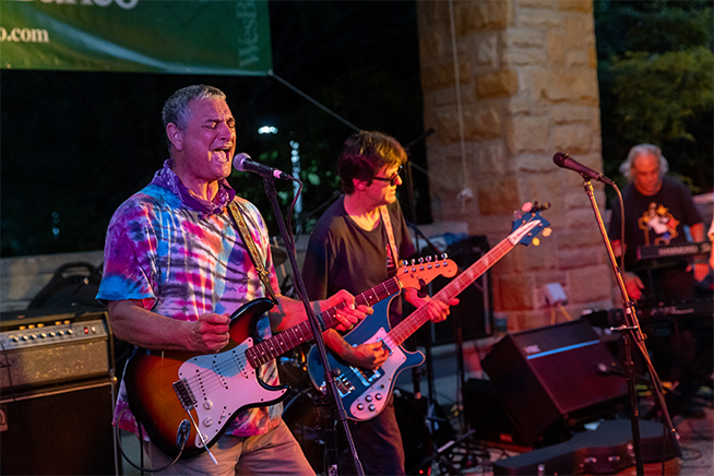
Check out what’s
Final Friday summer concerts